
Welcome to Nye Pond
East Sandwich, Massachusetts
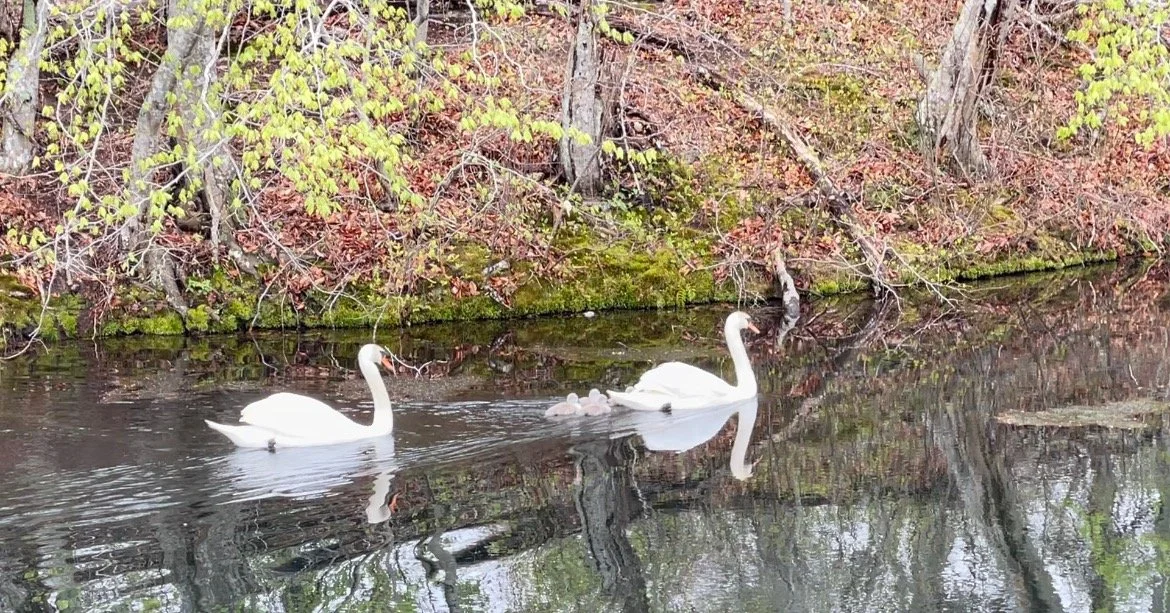
Our 6.2 acre pond is home to a diverse ecosystem and cherished habitat. The Town of Sandwich calls it one of our healthiest ponds. Help keep it that way
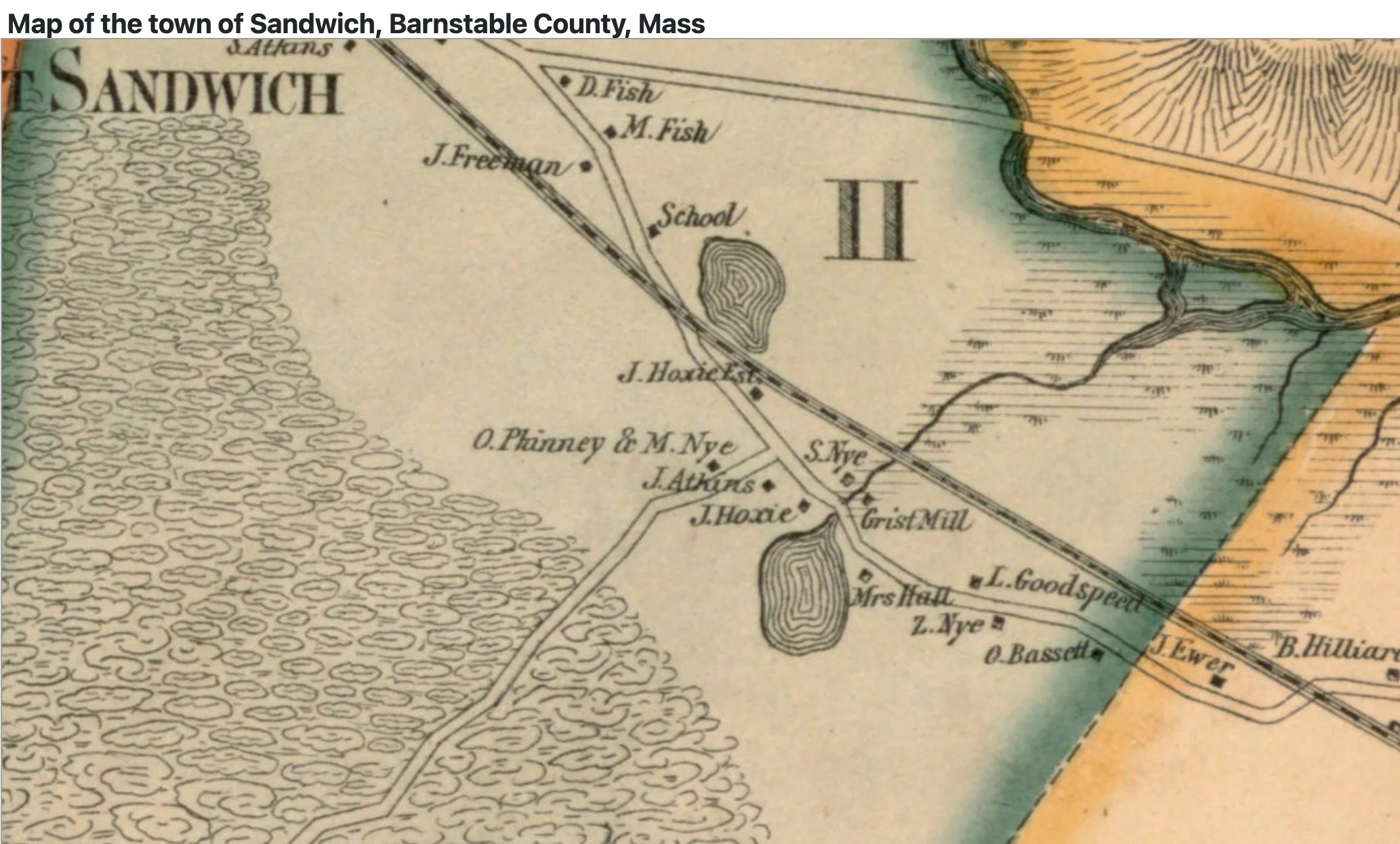
With little change or development, Nye Pond is a jewel of conservation and preservation. Originally a kettle pond, today’s pond was created 355 years ago by Benjamin Nye who built a mill and dam in 1669. The pond is the spring-fed headwater of the Scorton Creek estuary.
The mill became the heart of a thriving colonial community. The Nye homestead is now a museum, and 3 original Nye residences are preserved around the Pond. The residences were a tavern, a cobbler shop; and, by reputation, a stop on the Underground Railroad.


In 1933, the State of Massachusetts straightened the Old County Road, and rebuilt the dam and culvert. After 70 years of deferred maintenance and neglect, the dam has been identified as needing repair by the Massachusetts Division of Fish and Wildlife, “Mass Wildlife” who controls the dam. As remedy, Mass Wildlife plans to unnecessarily reduce the dam and lower the pond 3 feet. This option was chosen over repairing the dam although both options meet all the goals of Mass Wildlife, including fish connectivity to Scorton Creek.
This is not a dam removal project. It is a replacement with a smaller dam and culvert. The Mass Wildlife plan will remove 1/3 of the pond, or 2.2 acres of land under water. Navigable passage from the neck to the main pond will likely be lost, and the majority of the remaining pond will be less than 6 feet deep.
The pond will be more vulnerable to the effects of Climate Change. Lesser depths mean more vegetation as light penetration increases; and higher nitrogen levels found throughout the Cape accelerate this process; the resulting algea blooms choke the water and can feed cyanobacteria. Waters warm and oxygen is depleted.
Already in recent years, the pond has had substantially greater algea blooms that affect enjoyment of the pond.


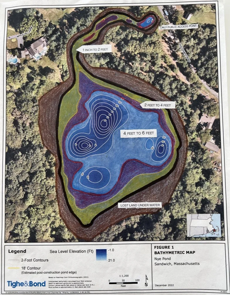
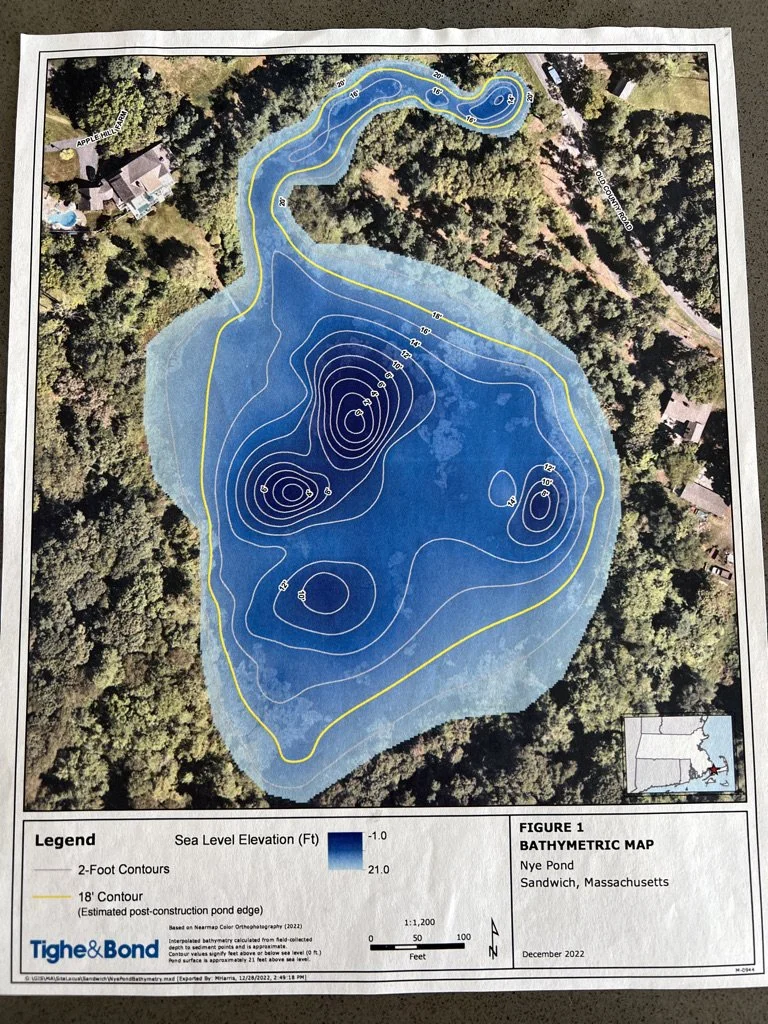
Bathymetric Maps
The map on the left was used by Mass Wildlife to get approval of its plan to lower the pond level 3 feet. It uses feet-above-sea-level, which is misleading because the large numbers do not denote the new depths of the pond. The map on the right uses the same map to describe new depths. Notice the new shoreline in black, the probable loss of a navigable passageway to the main pond, and how little of the pond will be more than 6’ deep.
In order to usher through its plan, the Secretary of Energy and Environmental Affairs, Rebecca Tepper, waived the State’s mandatory environmental review requirements. This project is planned to begin in the Spring 2025 without compliance to MEPA laws.
The goal of MEPA is to ensure that potential environmental impacts are considered and addressed before a project moves forward. It provides a public review process encouraging the minimization of damage to the environment and promotes government transparency in decision making.